
Hood Canal in Washington connects to Puget Sound where anthropogenic water and noise pollution from industry are problems. For the pollution issue, an oxygenation tunnel for low dissolved oxygen (DO) areas from Puget Sound to Hood Canal where designs are in CAD drawings for mapping placement. See the bottom of the page for drawings. View or download the Sea Grant detailed article on the problem below.
To support increased oxygen to acceptable levels for fish from about 1 mg/L Hood Canal and about 6 mg/L Puget Sound where a concentration of 5 mg/L DO is needed for optimum fish health, however, sensitivity to low levels of dissolved oxygen is species-specific. Most species of fish are distressed when DO falls to about 3 mg/L and mortality usually occurs at concentrations less than 2 mg/L according to internet sources.
Our approach is to add an oxygenation/aeration tunnel from Puget Sound to Hood Canal underground to Case Inlet/North Bay (Figures 3, 4 & 5) which is controlled by tides. A major concern is keeping the water passage free from debris including silt and sand with no way to know without scaled testing.
The tunnel addition for O2 level increase is not quantifiable at this stage of development, especially without scaled testing.
Another concept is an innovation in fish ladder design (Figure 1). Stacks of these ladders are needed for fish to climb and to get to the spillways or the top of dams.

Contact Rick Hicks (0rlhicks0@gmail.com) for copies of the fish ladder drawing, the oxygenation tunnel location, and the installation map drawings below.
Lake Cushman Dam and Lake Kokanee Dam (a.k.a. Cushman 1 & 2) are potential locations however, no readable and usable engineering drawings from the survey gallery are available online: https://www.loc.gov/resource/hhh.wa0270.photos/?sp=1&st=gallery
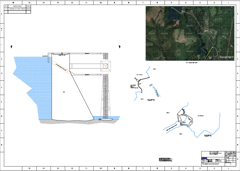
The concept of stacked fish ladders was made from vague information about the dams. The lower right view shows two potential locations. One is to the spillway, the other over the top of the dams used potentially for less tall dams elsewhere.
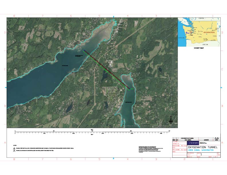
Tunnel location drawings.
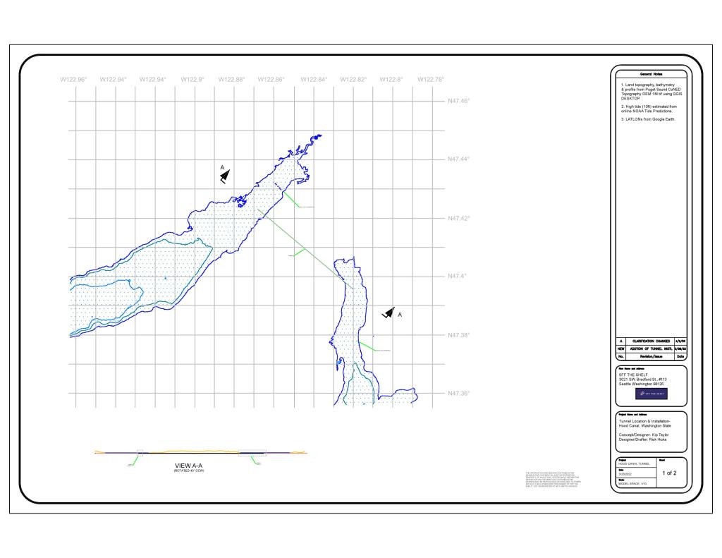
QGIS platform was used for bathymetry contour lines above and section profiles below that are developed from a digital elevation model (DEM).

Tunnel location front view. The tunnel is sloped slightly down (right to left) or from Case Inlet to Hood Canal to facilitate water pressure. The orange line represents land elevation 0, and the high tide shown is approx. 10 feet. The scale is 10/1 from Figure 4.
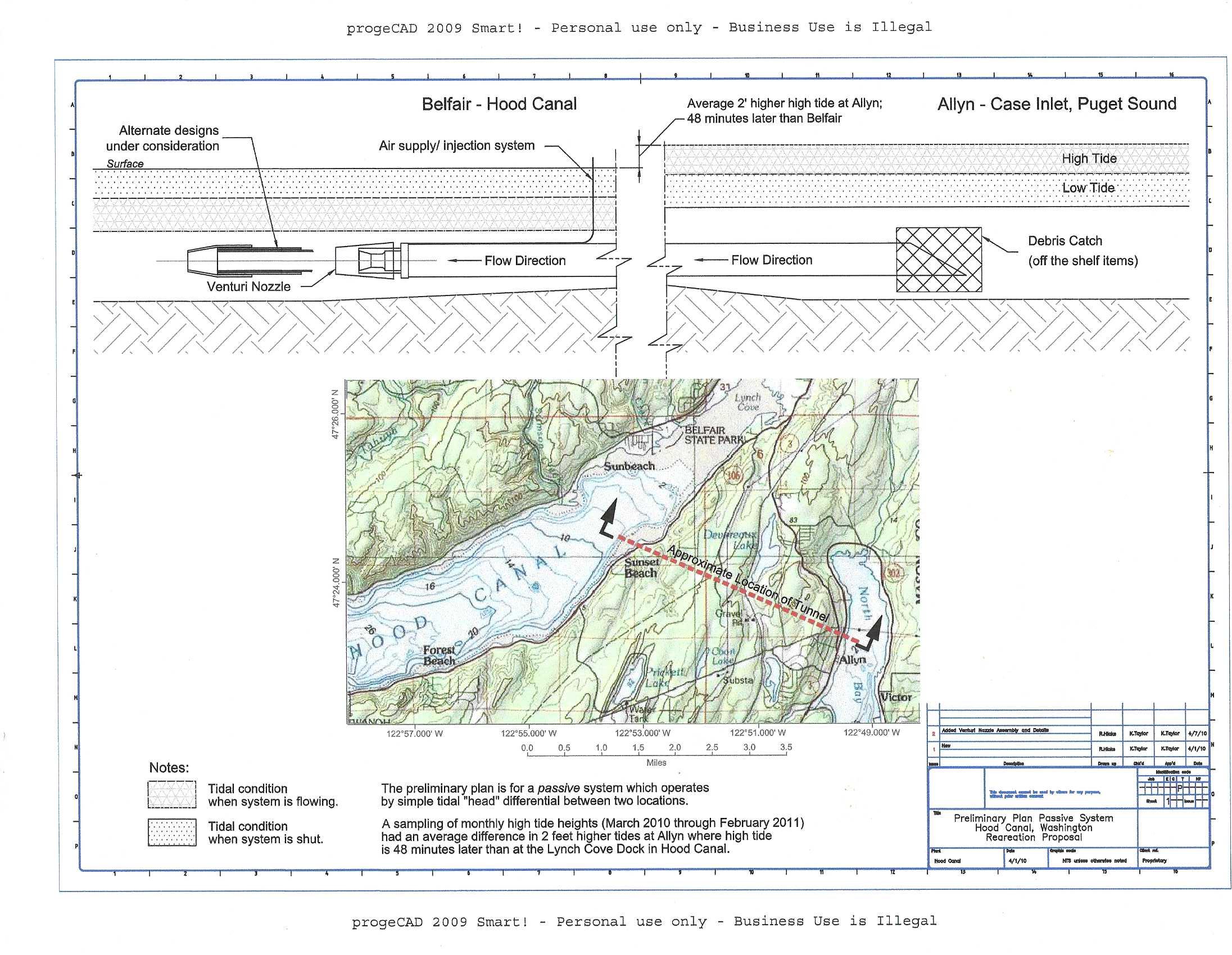
Before Kip Taylor passed away, the concept was different using a single venturi nozzle at the outlet. Those passive-plan drawings were kept and drawing scans are available from the links below. Thoughts were for the venturi system to have a bubbler-type (venturisysdetails links below) to add air, or air pump(s) to increase O2.
About us: Kip Taylor from Parkland, and formally in the Army Special Forces who attended Pacific Lutheran University and for three decades saw the degradation of Hood Canal. Richard (Rick) Hicks from Seattle, is a multi-disciplined freelancer and University of Washington (Bothell) graduate that worked 2 years at NOAA Fisheries on salmon recovery.
Welcome the Chinese for your several dozen views and other countries for your interest.
Last changed: 8/10/2025
